- Topographical / Detail Surveys
- Boundary Disputes / Legal Plans
- GIS Data Capture
- Landfill and Quarry
- Volume Analysis
Topographical Surveys
Greenhatch Group has a wealth of experience in topographical surveying, providing accurate mapping data representations of the physical features and arrangements to the construction and development industry for over 35 years.
Flexible to all requests, Greenhatch provide topographical surveys from the smallest of plots to the largest of developments. This encompasses all types of land, from greenfield and brownfield sites, urban and rural infrastructure, to local house and garden surveys.
We provide a wide service of expertise in the topographical field which includes the provision of the following primary services:
- Topographical / Detail Surveys
- Boundary Disputes / Legal Plans
- GIS Capture
- Landfill & Quarry / Volume Analysis
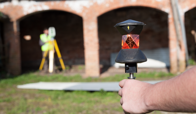
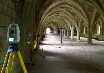
Topographical Surveys are undertaken using the latest surveying equipment, from Total Stations, Global Navigation Satellite Systems, 3D Laser Scanners and UAV’s. All surveys are controlled by a network of established control stations prior to topographical detail being collected by the most suitable and cost-effective method, determined by the management and project surveyor.
To maintain standards and achieve the required project accuracy we work to the ISO9001:2015 quality assurance system where provisional data is field checked, computational and redundancy checks undertaken and final drawings production undertaken under the supervision of management with final quality checks undertaken on every project.
With regional offices throughout the UK we are able to cover the whole country and maintain a quick and economical response to client enquiries. Greenhatch also has experience of working further afield and has the capacity to undertake projects overseas.


Survey output examples
Speak To Our Topographical Survey Experts, on+44 (0)1332 830044
OR EMAIL YOUR ENQUIRY
RESOURCES USED:
GEOMAX ZOOM 90 TOTAL STATIONS
GEOMAX ZENITH 15
LEICA VIVA TS15 & TS16 REDM 1" TOTAL STATIONS
LEICA GS08 & TRIMBLE R10 GNSS RECEIVERS LINKED TO OS ACTIVE NETWORK
TRIMBLE SX10 MULTI-STATION
LEICA P40 3D SCANNER
UAV's
TOPOGRAPHICAL SURVEYS INCLUDE:
Large & small scale topographical surveys
Earthwork quantities & volumetrics
Photo-montage surveys
Land Registry compliant plans and area calculations
As-built plans
Provision of geospatial data and mapping