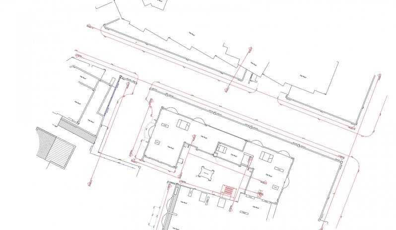
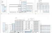
Rights of Light
Rights of Light surveys are undertaken for use with Consultant Daylight & Sunlight Planning Reports. Drawn information is often reduced in detail to identify the general structure and fenestration extents only.
Using a combination of roof plan layout and outline elevation drawings, consultants can build daylight calculation models for rights of lights assessments.
Data is often provided in an additional 3d point cloud form for further manipulation as a more comprehensive 3d building surface and terrain model.
Example information is highlighted below:

Speak To Our Measured Building Survey Experts, on+44 (0)1332 830044
OR EMAIL YOUR ENQUIRY
MEASURED BUILDING SURVEYS INCLUDE:
Detailed floor layout plans
Roof layout plans
Detailed facade elevations
Sectional details
Internal elevations
Historic archive recording
3D point cloud data sets in E57 & RCP
RESOURCES USED:
GEOMAX ZOOM 90 TOTAL STATIONS
GEOMAX ZENITH 15
FARO FOCUS S70
LEICA VIVA TS16 REDM 1" TOTAL STATIONS
LEICA GS10 SMART-NET ENABLED GNSS RECEIVER
Z&F 5010C LASER SCANNER
LEICA P40 LASER SCANNERS
FARO X330 LASER SCANNERS
GEOSLAM ZEB-REVO MOBILE MAPPING SCANNER
MIKROKOPTER OKTO XL 6S12
SONY A7Rii 42MP DIGITAL CAMERA & LENSES