Hardware Technology Employed
The Greenhatch Group have been utilising laser scanning technology since the first commercial availability of the original Cyrax Laser Scanning system in the early 2000’s. Our experience in this sector has been established by the use of each new piece of technology as time has progressed. We now have over seven years of expertise in the fields of terrestrial laser scanning applications and have utilised and combined all the different laser scanning technologies within the Greenhatch Group to enable specific products to be provided.
The information below highlights the wealth of experience we have gained over the years and also the technology and procedures adapted over time.
TOTAL STATIONS
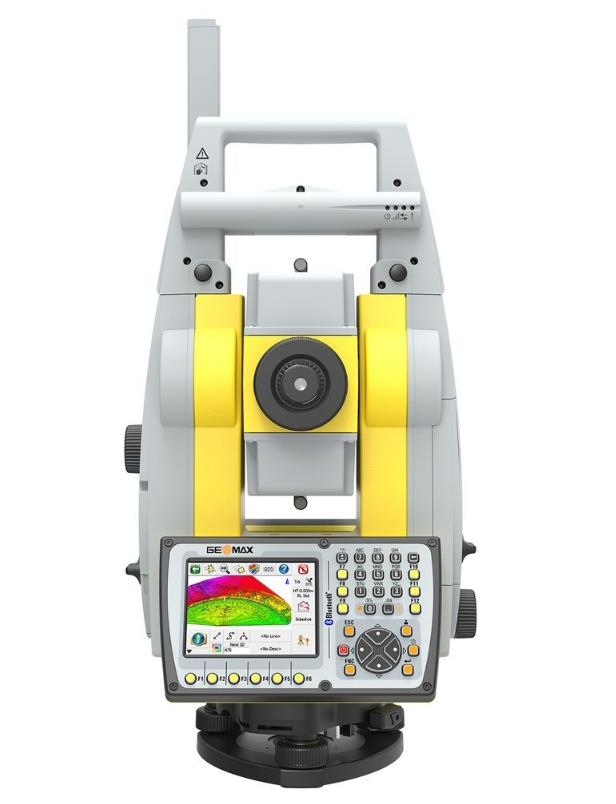
Geomax Zoom 90 Total Stations
The Zoom90 Robotic Total Station is the ultimate one-man system with up to 20% more automation performance, extended reflectorless measurement capability, STReAM360, accXess technologies, and Windows CE open connectivity. Zoom 90 Robotic Station Features: Fully Automatic: Longe range BlueTooth, X-MOTION hybrid™ drives, and an ultimate one-man system. Open Windows CE: Field software flexibility, Complete Windows CE functionality, and full VGA capability Outstanding Performance: STReAM360: Scout-TRack- AiM, 1000m reflectorless, and Precise capture.
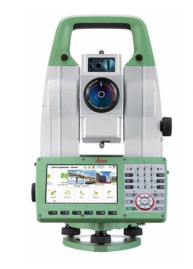
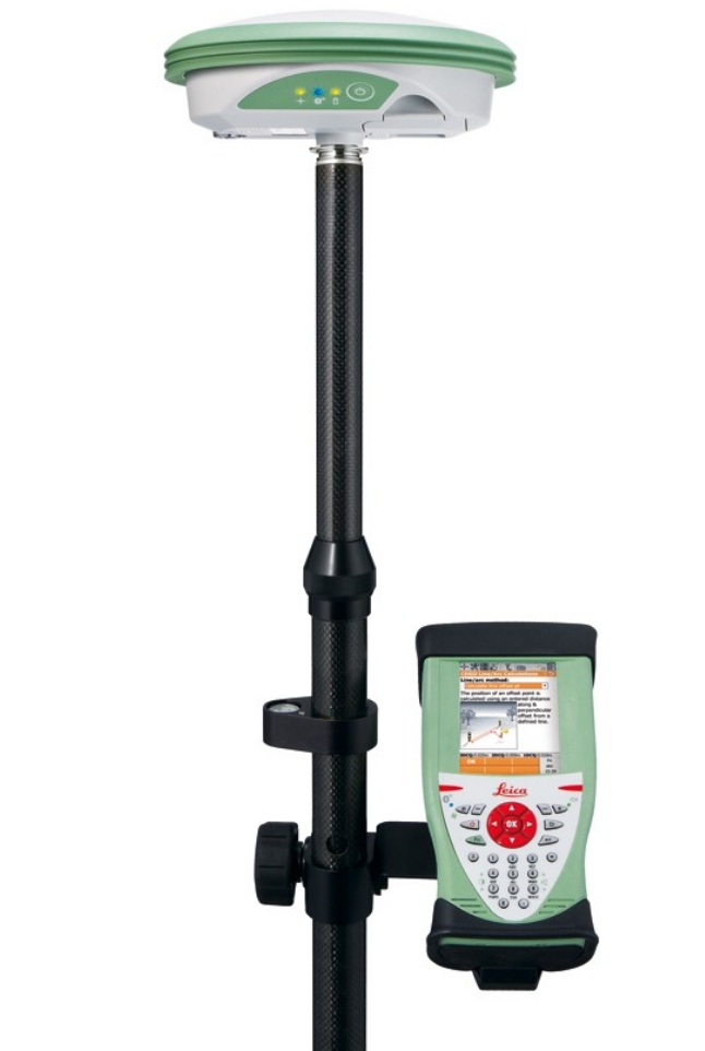
Leica Viva TS15 & TS16 REDM 1-5” Total Stations
The Leica Viva TS16 learns the environment, delivers accurate positions even in difficult dynamic applications, and offers the fastest re-lock in case of interrupted line of sight.
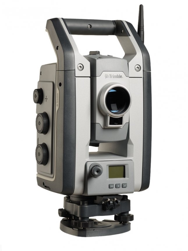
Trimble S9 HP
The Trimble S9 total station is built for specialized applications such as monitoring and tunnelling, where you need a solution with optimal speed, accuracy and reliability.
LASER SCANNERS
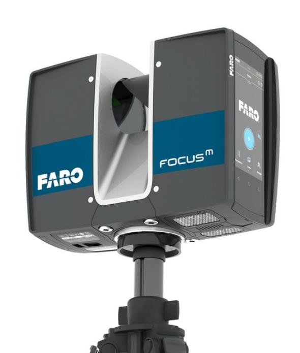
Faro Focus S70
The FARO Focus S70 delivers industrial grade performance with an exceptional price/performance ratio. This includes an Ingress Protection (IP) Rating of 54 for use in high particulate and wet weather conditions, HDR imaging and extended temperature range. Additionally, users will continue to have unrestricted freedom of choice to leverage the software tools most beneficial to their own workflow, including FARO SCENE and 3rd party software solutions such as Autodesk ReCap®.
The FARO FocusS70 also delivers a set of incremental, value-added functionality that makes it a perfect fit for those applications that require the short range scanning power of the FocusM 70, the next level accuracy of the FocusS150 or FocusS350 and the unique power of real time, one-site registration.
Short Range with Best in Class Accuracy:
• Designed for both indoor and outdoor applications that require scanning up to 70 meters and with accuracy of +/- 1mm
More Data Captured Faster:
• Delivers acquisition speed of almost 1,000,000 points per second
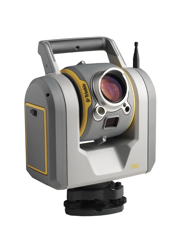
Trimble SX10 Multi-Station
The Trimble SX10 3D Scanning Total Station is new and pioneering, delivering the world’s most innovative solution for surveying, scanning and engineering by redefining the abilities of everyday survey equipment. The revolutionary Trimble SX10 3D Scanning Total Station can collect any arrangement of high-density 3D scan data, high accuracy total station data and enhanced Trimble VISION imaging, allowing users the ability to capture what they require, which results in an increase of productivity and time.
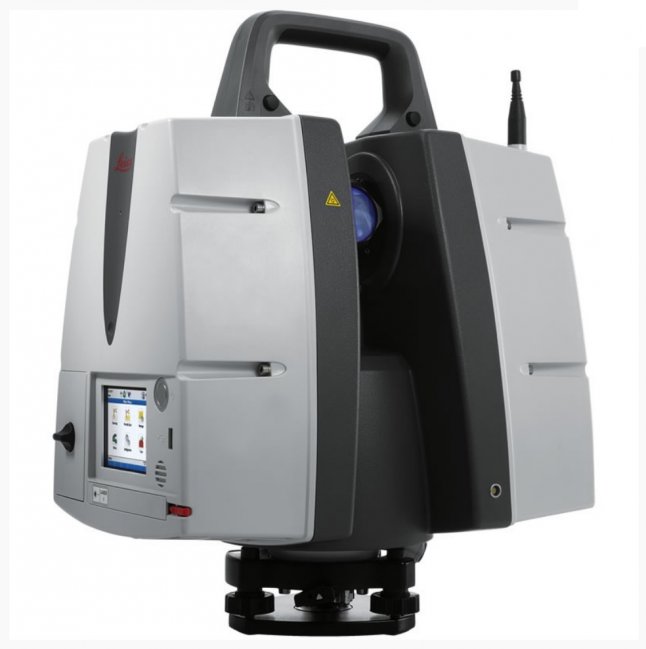
Leica P40 3D Scanner
The Leica Scan Stations deliver highest quality 3D data and HDR imaging at an extremely fast scan rate of 1 mio points per second at ranges of up to 270 m. Unsurpassed range and angular accuracy paired with low range noise and survey-grade dual-axis compensation form the foundation for highly detailed 3D colour point clouds mapped in realistic clarity.
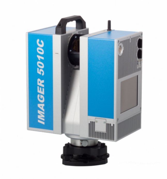
Z&F 5010C Laser Scanner
The terrestrial 3D laser scanner Z+F IMAGER® 5010C sets new standards for laser scanning! The integrated camera allows combining brilliant colours with high-resolution scan data. HDR-technology guarantees perfect illumination in all parts of the scene.
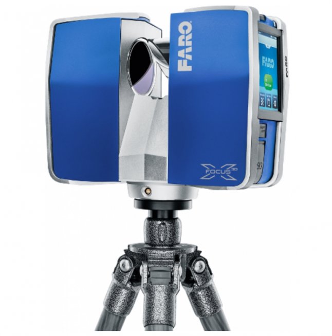
Faro X330 Laser Scanners
Building on the success of the Focus3D, the new Focus3D X 330 surpasses previous models in functionality and performance. With a range almost three times greater than previous models, the Focus3D X 330 can scan objects up to 330 meters away and in direct sunlight. With its integrated GPS receiver, the laser scanner is able to correlate individual scans in post-processing making it ideal for surveying based applications.
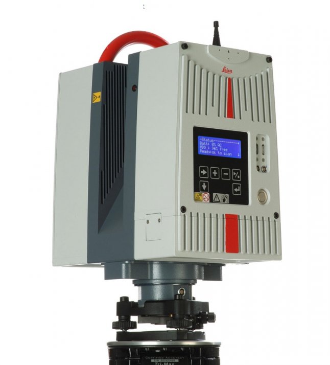
Leica 6200 HDS
The Leica HDS6200 features several advances that increase the versatility, portability, and productivity of ultra high-speed, phase-based laser scanning for many plant, architectural, tunnel, and heritage as-built survey applications.
MOBILE MAPPING
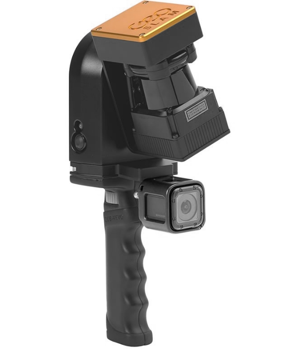
Geoslam ZEB-REVO
The ZEB-REVO is an incredibly versatile laser scanner which is very simple to use. It can be mounted onto your chosen mobile platform such as a vehicle or UAV, or used as a hand held scanner with a pistol grip. The sensor can also be attached to a pole to help you scan environments which are hard to reach or difficult to access. Pass through your target survey environment to record more than 40,000 measurement points per second.
GPS
Geomax Zenith 15
The GeoMax Zenith15 is a complete and fully integrated GNSS receiver, allowing the tracking of GPS and GLONASS systems. Available as GSM or GSM-UHF model, Zenith15 is your economic choice. Withstanding vibration and 2 m topple over, and unbeatable IP68 protection for dust and immersion in water, the GeoMax Zenith15 GNSS receiver is built to last, performing under extreme conditions. This resilience comes together with the unmatched Q-Lock™ technology, allowing you to track in challenging conditions. Combined with your preferred datalogger and field software, you have full flexibility and open connectivity in the field.
With an integrated GSM antenna and quick swappable SIM and microSD cards, the Zenith15 is made to be compact and easy for movement. Experience complete control with the receiver keypad. The Zenith15 is made for the future with GSM/GPRS/UMTS,UHF Radio and Bluetooth®. It supports GPS, GLONASS, and SBAS with NovAtel® technology. With an IP68 certification, the Zenith15 is dust and waterproof. It can withstand a 2 m drop and is vibration resistant.
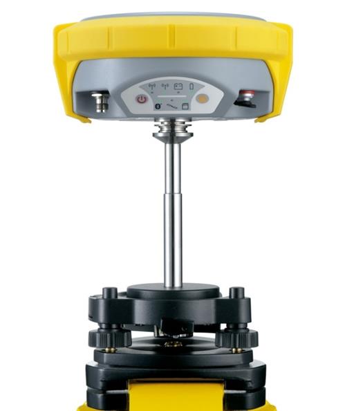
Leica Viva GNSS GS08 Plus Receiver
The most cable free and compact GNSS receiver setup, the Leica Viva GS08plus is light-weight whilst still flexible and is the right choice for many surveying projects. The Leica GS08plus is the complete integrated and compact GNSS solution.
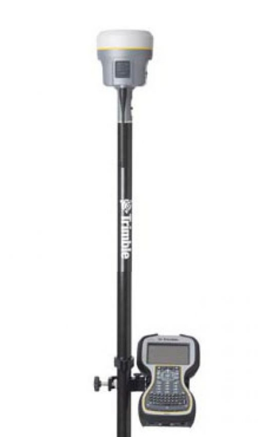
Trimble R10 GNSS
The Trimble® R10 LT GNSS System includes powerful technologies like Trimble HD-GNSS and Trimble 360 for remarkably fast convergence and positioning accuracy integrated into the Trimble R10 ergonomic and lightweight design, this unique system provides Surveyors with a powerful way to increase productivity in every job, every day. The Trimble R10 LT offers upgrade options to scale up to provide Trimble SurePoint™, for tilt compensation; Trimble xFill™ for seamless RTK level accuracy even with correction stream interruptions; and Trimble CenterPoint™ RTX for satellite and internet corrections extended indefinitely.
UAS

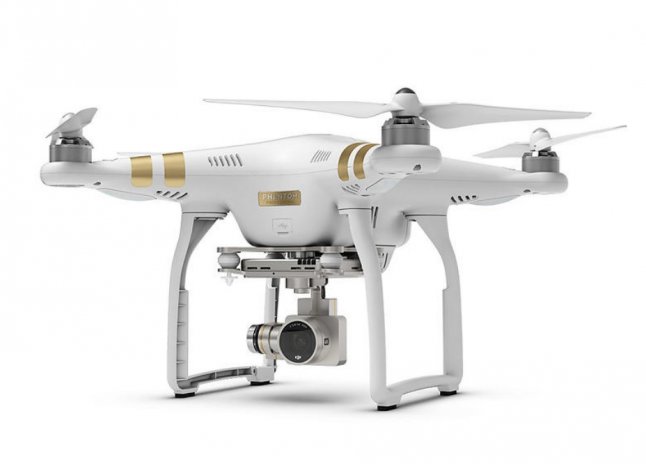
DJI Phantom 4 Pro Plus
The Phantom 4 Pro Plus features 5-direction obstacle avoidance. What’s really impressive is that it can automatically dodge and weave obstacles when it’s flying at high speeds, just when you need obstacle avoidance the most. These clever sensors on the front, back, left, right and underside actively scan the environment around the drone, seeing as far as 30m, enabling the drone to automatically avoid pesky things like trees, buildings and whatever else you might encounter.
The Pro captures 20mp images and has been equipped with a 1-inch CMOS image sensor, that’s about four times bigger than the sensor on your camera phone, this is what lets you capture much more detail. Everything has been thought of, it has a mechanical shutter so you can say goodbye to rolling shutter effect and with the ability to now change the aperture settings you’ll have more control over your shots. Video is really impressive, you can shoot in 4K at up to 60fps or 1080p at 120fps, which is great for creating slow-mo footage. The 3 axis gimbal will ensure you’re footage is smooth and seamless.
Crash risk is reduced with automatic 5 direction obstacle avoidance. Professional level photography with the 1” CMOS image sensor camera shooting 20mp images. Shoot video in 4K at 60fps or 1080p at 120fps, perfect for slow-mo footage. See the sights for longer with an Impressive 30 minute flight time. Outstanding range, live HD video from up to 4.3 miles away.
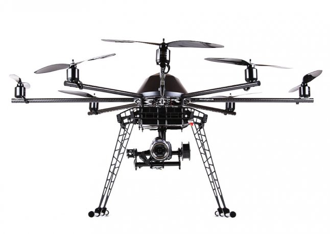
Mikrokopter Okto XL 6S12
The latest model octocopter 6s12 has many features that are in copter using GPS. Among them: retention of height and position in the horizontal plane; flight on the previously specified coordinate & automatic return home to the starting point of the flight with the loss of signal. With the new Brushless controller V3, the Motor MK3644 and a powerful 6S LiPo this copter can handle a payload up to 4Kg.
DJI Phantom 3 Professional
A complete 4K camera and 3-axis gimbal system. In addition to video, the camera is capable shooting up to 12MP still photos using JPEG or non-proprietary DNG RAW format. The three axes of the gimbal give you pan and tilt control, and keep the horizon line level even as the aircraft banks. Different gimbal settings allow the camera to lock onto a fixed subject, be moved manually using transmitter rotaries or the app, or to simply provide camera stabilisation.
PHOTOGRAMMETRIC
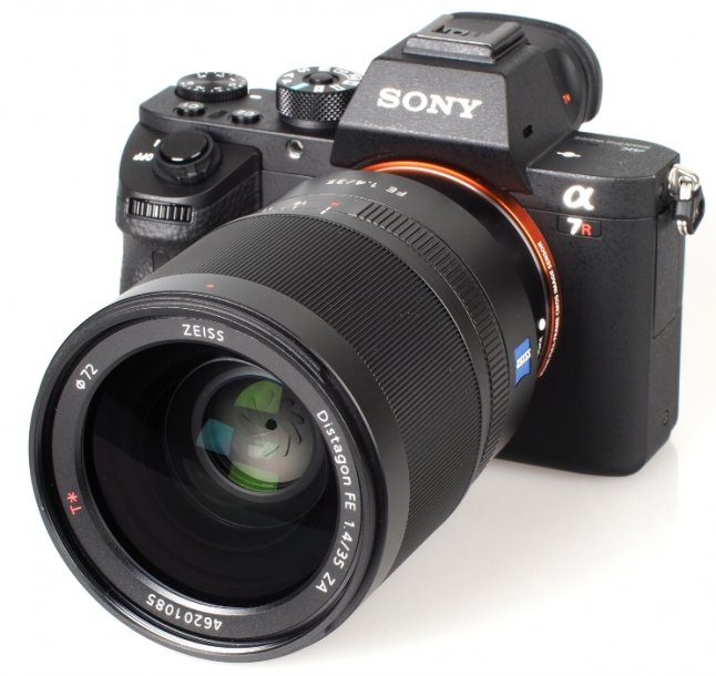
Sony A7Rii 42MP digital camera & lenses
The tough and durable Sony a7RII features the world’s first back-illuminated 35mm full-frame CMOS image sensor with 42.4 megapixels. The Sony ?7R II takes image resolution, sensitivity (up to ISO 102400) and speedy response to new heights. The Fast Hybrid AF system's dense extra-wide focal plane phase-detection AF coverage keeps a subject in sharp focus entirely throughout the frame, while 5-axis image stabilization reduces blur. High resolution is further enhanced by 4K movie recording featuring full pixel readout without pixel binning.
Utilised with 16-35mm, 35mm, 55mm,100mm and 70-200mm lenses.
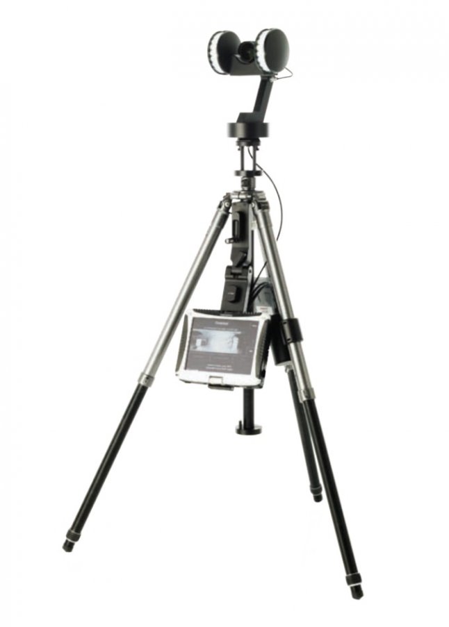
Spheron Spherocam HDR 360° camera
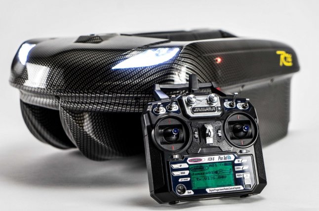
SonaMite echo sounder RC Boat
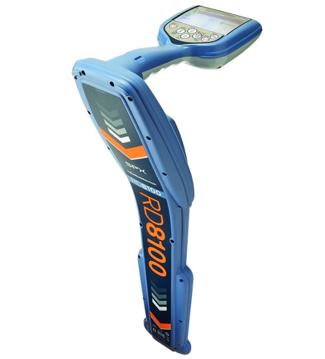
Electromagnetic Location Equipment (Cat & Genny RD8100)